Why drive up from Kotor at all
From the quay in Kotor’s old town, Lovćen looks like a wall of grey limestone rising straight out of the Bay of Kotor. It’s hard to picture a road up there at all, let alone one with two dozen bends stacked on top of each other. That road exists, it’s drivable in a normal car, and it is one of the more dramatic short drives on the Montenegrin coast — not because of any single monument, but because the bay keeps reappearing below you, smaller and wider each time, until it looks like a map rather than a place you were standing in an hour earlier.
Lovćen National Park itself covers a stretch of the Lovćen massif between Kotor and Cetinje: beech and black pine forest, exposed karst ridges, a scatter of stone shepherd’s huts (katun) and a road network built for a 19th-century capital that no longer functions as one. Most visitors come for two things — the old road’s viewpoints and the summit mausoleum — but the mausoleum has become the headline attraction while the road and the park around it get treated as a means to an end. That’s a mistake. Give the road itself 45 minutes without rushing and it’s the best-value scenic drive within an hour of Kotor.
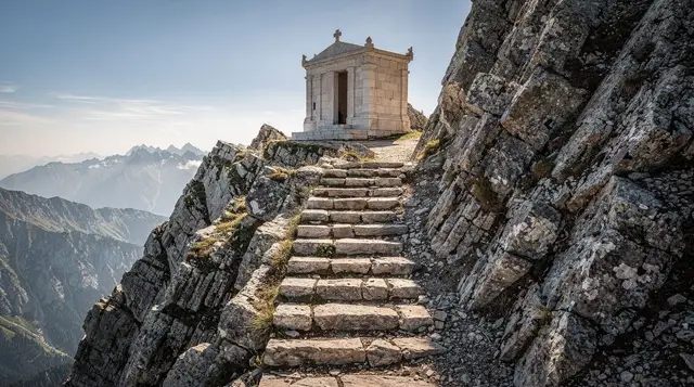
This page covers the park and the historic road up from Kotor. If you want details on the mausoleum at the top — opening hours, the 461 steps inside, what Njegoš actually built and why — that has its own guide.
The old Njeguši road: what the 25 hairpins actually look like
The road climbs out of Kotor behind the old town, past Škurda, and starts switching back almost immediately. It was built under Austro-Hungarian administration in the late 19th century as the main link between the coastal garrison at Kotor and Cetinje, then the seat of Montenegrin royal government — a road designed for horse-drawn traffic and troop movement, not modern cars, which explains the tight radius on many of the bends.
Locals and route descriptions put the count at around 25 hairpins in the steepest section, climbing roughly 900 metres in a few kilometres of horizontal distance. The surface is sealed asphalt for most of the route today, though narrow — often one comfortable lane with passing space rather than two marked lanes — with low or absent guardrails on the outside edge of several bends. None of that makes it dangerous at sensible speed, but it does mean this isn’t a road for texting, overtaking, or driving while trying to photograph the bay one-handed. Pull into one of the small laybys to stop instead.
What makes the drive worthwhile is the repetition: at each bend the bay reorganises itself below you. Low down, you see Kotor’s rooftops and the marina close enough to make out individual boats. Halfway up, the whole inner bay opens out — Kotor, Dobrota, Prčanj, Perast and the two islets off Perast all visible at once. Near the top, before the road levels into the park’s forested plateau, the bay reduces to a silver shape against the mountains, and you can see how the whole system of inlets folds back on itself, which is difficult to grasp from sea level.
Driving it well
| Condition | Advice |
|---|---|
| First-time drivers, nervous with heights | Consider a private tour or taxi instead of self-driving |
| Large SUV, van or campervan | Use the modern Cetinje road instead; passing is tight |
| Wet weather | Drive slower; the asphalt gets slick on the tighter bends |
| Fog | Avoid — visibility on blind corners drops to a few metres |
| Night | Avoid — no lighting and minimal reflective markers |
| Cycling | Doable for confident road cyclists; light traffic outside summer weekends |
The road is one-way in neither direction — traffic moves both ways on the same narrow carriageway — so you will meet descending cars on the way up, usually at the bends rather than the straights. Slow down early, and expect the occasional local driving it faster than you’d like; this is still someone’s daily commute between Kotor and Njeguši.
What the national park actually protects
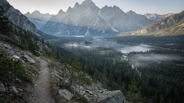
Lovćen was declared a national park in 1952, one of Montenegro’s oldest protected areas, covering a stretch of the Lovćen massif that sits at the meeting point of the coastal Mediterranean climate and the harsher continental climate of the interior. That collision is why the vegetation changes so quickly as you climb: Mediterranean scrub and vineyards near Kotor give way to beech and black pine forest within a few kilometres, and the exposed limestone ridges near the summit support almost nothing but low alpine plants and the wind.
The terrain is classic karst — sinkholes, dry stone walls, no visible surface water for long stretches, and a landscape shepherds have grazed for centuries using seasonal stone huts. You’ll pass a scatter of these katun structures on the plateau, some restored, some ruined, a reminder that this was working pastoral land long before it was a park boundary on a map. Wolves, chamois and a range of birds of prey use the park’s less-visited slopes, though sightings from the road are rare — most visitors’ wildlife experience is limited to the cats sunning themselves outside Njeguši’s roadside stalls.
The park’s plateau — the flatter stretch of road and grazing land between the top of the switchbacks and the base of the summit access road — is where most non-hiking visitors spend their time: a couple of viewpoints, the entrance booth, a handful of small restaurants, and the turn-off for Njeguši village. Hikers heading further into the park’s marked trails, including routes up toward the ridge, will find that covered in the national park hiking guide — this page sticks to what you see from the road and the plateau.
Where to stop: the best viewpoints on the way up
There’s no need to plan exact stopping points — laybys appear naturally at the wider bends — but a few sections stand out:
- Lower switchbacks (bends roughly 1–8): Kotor’s old town and the marina dominate the view, close enough to pick out the cathedral’s two towers.
- Mid-climb (around the halfway mark): the whole inner bay opens up, including Perast and the two islets, Our Lady of the Rocks and the natural islet of Sveti Đorđe.
- Upper switchbacks, just below the park boundary: the last clear view before the road turns inland into forest — worth the stop because from here the bay’s full shape, the ria rather than a simple inlet, finally reads as one system.
- The plateau viewpoint near the park entrance booth: a wider pull-off with space to park properly rather than balance on a bend, usually where tour minivans stop.
None of these are marked with official signage in the way a national park in Western Europe might mark them — you’re watching for a wide enough shoulder and a gap in traffic, not a car park with a sign. Early morning, before 9am, has the clearest light and the fewest other cars; midday haze in July and August can flatten the view considerably.
Njeguši village and what to do there
The road levels out onto the plateau at Njeguši, a scattering of stone houses that has been producing the country’s best-known cured ham and cheese for generations. This isn’t a manufactured tourist stop — it’s a genuine mountain village that happens to sit on the only road between Kotor and Cetinje, and it has built a small, honest food economy around travellers passing through.
Roadside stalls and small restaurants sell njeguški pršut (air-dried ham, cured in the mountain air rather than smoked) alongside njeguški sir, a firm, salty mountain cheese, often served together on a wooden board with olives and bread.
A tasting plate for two typically runs somewhere in the €10–20 range depending on where you stop; sit-down restaurants serving a full lamb or veal ispod sača meal (cooked under a metal dome buried in embers) cost more and usually need advance notice or at least an early order, since the dish takes hours. For the full picture on producers, tastings and etiquette, see the Njeguši village guide and the dedicated pršut and cheese guide.
Njeguši is also the birthplace of the Petrović-Njegoš dynasty, and the small family house associated with them sits in the village — a modest stone building, not a grand palace, in keeping with the mountain setting.
Entrance fees and practical details
Lovćen National Park charges an entrance fee, collected at a booth on the road once you’re inside the park boundary — separate from any ticket for the summit mausoleum further up, which has its own charge covered on its guide page. The park fee is modest, typically a few euros per person or per vehicle depending on how it’s structured that season, and the booth is usually cash-only, so carry small euro notes.
| Item | Approximate cost |
|---|---|
| Park entrance | A few euros per person or vehicle |
| Fuel, Kotor–Lovćen–Kotor round trip | €5–8 for a small car |
| Njeguši tasting plate for two | €10–20 |
| Full sit-down meal (ispod sača, needs advance order) | €25–40 for two |
| Private driver or tour, half day | Varies by operator and group size |
Toilets and food options thin out quickly once you leave the plateau, so plan around Njeguši rather than assuming facilities further into the park. Mobile signal is patchy on the lower switchbacks and improves on the plateau. There’s no fuel station on the mountain itself — fill up in Kotor before you start climbing.
Boat, car or private tour: how to see it
This is a road trip, not a boat excursion, but it’s worth being clear about the options since Kotor’s tourism economy is built so heavily around boats and group tours:
- Self-drive: the most flexible option and the only way to control your own stopping points on the switchbacks. Needs a rental car (see the car rental guide) and confidence on narrow mountain roads. Parking in Kotor itself before you set off is limited — the parking guide covers where to leave a car if you’re staying inside the old town.
- Private tour with a driver: removes the stress of driving the bends yourself and usually includes commentary on the road’s history and stops timed to the best light. A Lovćen hiking private tour style trip, such as a private hiking excursion up to Lovćen, typically combines the drive with a short walk on the plateau or ridge rather than just a photo stop.
- Combined Njeguši tour: several operators pair the drive with a village stop, and a guided village visit with a home-hosted prosciutto and cheese tasting is a reasonable way to get the food experience without guessing which roadside stall is worth your time.
- Group minivan tour: cheaper per person and common in peak season, usually stacking Lovćen with Cetinje or Njeguši in one day. A broader Lovćen and Njeguši mountain tour covers the road, the village and a viewpoint stop in a single half-day.
- Standalone private transfer: if you only want the road and the summit without a village stop or hiking component, a straightforward private tour to Lovćen is the lightest option.
None of these require booking weeks ahead outside July and August; a day or two’s notice is usually enough, though summer weekends do fill private drivers faster than midweek.
Where this fits in a Kotor Bay itinerary
Lovćen works best as a half-day loop rather than a full day, unless you combine it with Cetinje, which sits only around 15–20 minutes further on the modern road beyond the park. A common pattern: leave Kotor mid-morning after the cruise crowds fill the old town, drive the old road up, stop in Njeguši for lunch, continue to Cetinje for the afternoon, and return to Kotor via the faster modern route rather than repeating the switchbacks in fading light. That version of the day is covered in more detail in the Cetinje day trip guide.
If you’re building a longer stay around Kotor, Lovćen slots naturally into a two-day Kotor itinerary as the inland counterpart to a coastal or boat-focused first day, and it’s one of the standard stops in a broader national parks tour that also takes in Durmitor and Biogradska Gora further north. Whichever pace you choose, aim for late May to early October — outside that window the road is passable but the plateau’s restaurants and stalls thin out considerably, and snow occasionally closes the upper bends.
FAQ about the Lovćen road and national park from Kotor
How many hairpin bends are on the old Njeguši road?
Around 25, built under Austro-Hungarian administration in the late 19th century to link Kotor with Cetinje, then Montenegro’s capital. The exact count depends on how tightly you define a bend, but locals and maps agree on roughly two dozen switchbacks in the steepest section above Kotor.
Can I drive the old road in a rental car?
Yes, most rental cars manage it fine, but it is narrow, has minimal guardrails and no lighting. Avoid it after dark, in fog or with a large SUV or campervan — passing oncoming traffic on the tighter bends can mean reversing to a wider point.
Is there an entrance fee for Lovćen National Park?
Yes, there’s a small per-person or per-vehicle entry charge collected at a booth on the road inside the park boundary, separate from any ticket for the Njegoš Mausoleum further up. Fees are modest, typically a few euros, and are usually cash-only.
How long does it take to drive from Kotor to Lovćen?
Around 45–60 minutes via the old Njeguši road, driven slowly because of the bends. The modern route through Cetinje is faster in distance terms but longer overall, and misses the switchback views entirely.
Is the old road open in winter?
It’s officially open but can ice over or be affected by snow between November and March, especially in the higher, shaded bends near the park entrance. Locals often prefer the Cetinje road in winter; check conditions before committing to the old road outside the warmer months.
Do I need to see the Njegoš Mausoleum to enjoy Lovćen?
No. The mausoleum sits at the park’s highest point and is a worthwhile add-on, but the park and the drive up are a complete experience on their own — forest, karst scenery and the switchback views are the main draw for many visitors who skip the final climb to the summit.
Is the road suitable for cyclists?
Experienced cyclists do ride it, but it’s a serious climb of around 900 metres in elevation with narrow shoulders and blind bends, so it suits confident road cyclists rather than casual riders. Traffic is light outside peak summer weekends, which helps.