The Ladder of Kotor: hiking the old mule path to Krstac
How long does it take to hike the Ladder of Kotor?
Most walkers need three to five hours to climb from Kotor's old town to Krstac pass, depending on fitness and how many stops you make for photos and water. The path gains roughly 900 metres over about 10 to 12 kilometres of zigzagging track, so it is a serious half-day hike, not a stroll.
From mule track to hiking trail
Before the modern road to Cetinje existed, everything that moved between the coast and the interior of Montenegro went up this way, on the backs of mules and porters. The Ladder of Kotor — Kotorske Ljestve in Montenegrin — is the old Austro-Hungarian track that climbs out of the old town of Kotor, past the San Giovanni fortress, and keeps going up the mountainside in tight zigzags until it reaches Krstac pass, near Njeguši, on the road toward Cetinje.
It is not the same route as the paved road with its hairpin bends above the bay, which cars and buses use today. That old road has its own set of roughly 25 turns cut into the mountainside. The Ladder of Kotor is a separate, older, unpaved path, built for feet and hooves rather than wheels, and the two only meet again near the top. Traders once carried salt, wine and other goods up this track from the coast and brought down prosciutto, cheese and produce from the villages of the Cetinje plateau. Today almost nobody uses it to move goods. It is walked by hikers who want the view the traders had, without the road noise.
How long the climb actually takes
Give yourself the whole morning, or the whole afternoon if you start with plenty of daylight left. The honest range is three to five hours from the edge of Kotor’s old town to Krstac pass, and that is climbing only — the descent, if you walk it, adds more time on tired legs. Fit, regular hikers moving briskly with few stops can do it toward the lower end of that range. Most visitors, especially in summer heat, should plan for four hours or more, with water breaks.
| Stage | Approximate distance | What to expect |
|---|---|---|
| Old town to San Giovanni base | 0.5–1 km | Steps and a paved path, the busiest section, shared with fortress visitors |
| San Giovanni to mid-slope switchbacks | 2–3 km | Loose stone track, tighter zigzags, tree cover thins out |
| Mid-slope to open ridge | 3–4 km | Exposed scrub and rock, the bay view opens up fully, no shade |
| Ridge to Krstac pass | 3–4 km | Gentler gradient, joins the old road corridor near the top |
Treat the distances as approximate — this is not a waymarked, resurfaced trail with kilometre posts, and different guides and GPS tracks give slightly different totals depending on exactly where they start counting. What does not vary is the overall character: a long, steady, often steep climb with very little flat ground until you are close to the top.
The lower section: sharing the path with fortress visitors
The first stretch out of the old town follows the same route as the climb to San Giovanni fortress, so if you are hiking the Ladder of Kotor in the morning, expect company on this part — day-trippers who are only going as far as the fortress walls, not continuing on to Krstac. Past the fortress entrance, the crowd drops away almost completely. Very few people who buy a ticket for San Giovanni carry on up the mule track; most turn around and walk back down into town.
This is also the only section with any real shade, from scattered trees and the fortress walls themselves. Once you are above the fortress, the path opens onto bare mountainside and stays that way for most of the remaining climb.
The middle and upper switchbacks
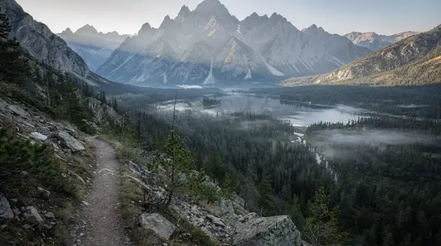
This is the core of the old track: a long series of tight zigzags cut directly into the slope, unpaved, sometimes loose underfoot, always steep. There is no ambiguity about the gradient here — it climbs steadily, without long flat stretches to recover on. The compensation is the view, which gets better with every switchback: the full sweep of the Bay of Kotor, the old town shrinking below, cruise ships in port looking like toys, and eventually the interior plateau opening up on the other side as you near the top.
Sun exposure is the main hazard on this section, not technical difficulty. There is no shade, no water source, and depending on the time of year the rock can radiate heat back at you. Anyone attempting this in July or August should be moving well before the day heats up — see our notes on the best time to visit Kotor for how the season changes what a climb like this feels like.
Reaching Krstac and the villages beyond
Near the top, the mule track meets the old road corridor close to Krstac pass, within reach of Njeguši, the village famous across Montenegro for its air-dried prosciutto and hard mountain cheese. If your legs and your schedule allow it, this is the natural place to stop, eat, and decide how you are getting back down — see our Njeguši village guide and our prosciutto and cheese guide for what to look for once you are there.
Some hikers continue further, connecting toward Cetinje or the Lovćen national park trail network, but that adds a serious amount of additional walking on top of an already long day.
Coming back down: don’t just retrace your steps
This is the part most first-time hikers get wrong. The Ladder of Kotor is steep enough climbing up; walking back down the same loose zigzags on tired legs is harder on the knees and takes nearly as long as the ascent, with a real risk of a slip on the loose surface as fatigue sets in late in the day.
The better option, and the one most local guides recommend, is to arrange a taxi or a pre-booked driver to meet you at Krstac or in Njeguši and take you back down to Kotor by road. It is a short drive — 20 to 30 minutes depending on traffic — compared with two or more additional hours on foot. Agree a price before you get in, since meters are rarely used with visitors; our taxis in Kotor guide covers how that works in practice. If you are driving yourself and left a car in Kotor, this means organising a lift or a taxi in advance rather than expecting to flag one down easily at the top — phone signal in the upper switchbacks is patchy, so make the arrangement before you set off, not once you are up there.
Drivers who prefer to do this as a there-and-back drive rather than a hike can also simply take the old road up to Njeguši and back; see our car rental guide and note that parking is tight in Kotor itself, covered in our parking in Kotor guide.
Practical checklist
| Item | Why it matters |
|---|---|
| Sturdy walking shoes | The surface is loose stone in long stretches; sandals are not enough |
| 1.5–2 litres of water per person | No water source on the mountain; the climb is exposed and physical |
| Sun hat and sun cream | Almost no shade above the fortress |
| Early start | Before 8am in summer avoids both heat and the busiest hour on the lower path |
| A plan for the way down | Book a taxi or driver in advance rather than relying on signal at the top |
| Cash for a driver | Card machines are unreliable outside town; agree the price first |
Who this hike suits
This is not a hike for anyone who struggled with the steps up to San Giovanni fortress. It suits reasonably fit walkers comfortable with several hours of continuous, unshaded uphill effort, ideally in cooler months or very early in the day during summer. It does not suit young children, anyone with knee or hip problems expecting an easy descent, or visitors short on time — this needs the better part of a day, not a spare hour between lunch and a boat trip.
If you want the views and the sense of scale without committing to the full climb to Krstac, the Vrmac ridge trails on the other side of the bay offer a shorter alternative with comparable panoramas over Kotor and the bay, and pair well with a single day trip from town — see our one-day Kotor itinerary for how to fit either option in.
Guided options if you’d rather not navigate alone
The path is not signposted to modern trail standards, and route-finding through the lower switchbacks in particular can be confusing on a first attempt. A guide who knows the exact line saves time and uncertainty, and several local operators run this as a structured route rather than a self-guided scramble.
a guided climb above Kotor that follows this stretch of mountainside with a local hiking guide is the most direct match for this route, typically including transport back down so you are not left arranging your own taxi from Krstac. For a shorter, ridge-based alternative on the opposite side of the bay, a guided walk along the Vrmac ridge with panoramic views over Kotor Bay covers similar terrain in less time. Those who prefer a private pace rather than a group can book a private guided hike on Vrmac, and anyone travelling with birdwatchers in the group might combine the climb with a guided birdwatching outing in the same hills, since the upper slopes see genuine raptor activity away from the crowds below.
Ladder of Kotor: frequently asked questions
How long does it take to hike the Ladder of Kotor?
Most walkers need three to five hours to climb from Kotor’s old town to Krstac pass, depending on fitness and how many stops you make for photos and water. The path gains roughly 900 metres over about 10 to 12 kilometres of zigzagging track, so it is a serious half-day hike, not a stroll.
Is the Ladder of Kotor the same as the road with the hairpins to Njeguši?
No. The old road to Njeguši, used by cars, has its own set of tight hairpin bends above the bay. The Ladder of Kotor is a separate walking path, the old Austro-Hungarian mule track, though both routes converge near Krstac pass at the top.
Do I need to walk back down the same way?
You don’t have to, and most people don’t. Arranging a taxi or a pre-booked driver to collect you at Krstac or in Njeguši and drive you back down to Kotor saves your knees and around two hours compared with descending the same zigzags on foot.
Is the Ladder of Kotor harder than the San Giovanni fortress climb?
Yes, considerably. San Giovanni is around 1,350 steps and 45 minutes to an hour and a half. The Ladder of Kotor continues well past the fortress, gaining several hundred more metres over a much longer, more exposed, unpaved track.
Is there shade or water along the way?
Very little of either. The lower section near the fortress has some tree cover, but most of the upper path is open scrub and rock with no shade and no reliable water source. Carry everything you need before you start.
What should I wear and bring?
Proper walking shoes with grip, not sandals — the surface is loose stone in places. Bring at least 1.5 to 2 litres of water per person, sun protection, a hat, and a phone with the route downloaded, since signal is patchy in the upper switchbacks.
When is the best time of day to start?
Start by 7.30am to 8am in summer, before the heat builds and before cruise-ship crowds fill the lower path near San Giovanni fortress. Spring and autumn allow a slightly later start, but afternoon heat still makes a midday climb unwise.
Mountain excursions on GetYourGuide
Verified deep-linked GetYourGuide tours. Book through these links and we earn a small commission at no cost to you.
GetYourGuide does not provide a product photo for this activity — the image shows the meeting point, photographed by us.