Vrmac ridge hiking guide
How hard is the Vrmac ridge hike from Kotor?
The full ridge traverse to the Austrian fort and back covers roughly 12-14 km with about 500-600 m of ascent, taking 4-5 hours. Shorter loops from Muo or Dobrota reach the fort and its dual-bay viewpoint in 2-3 hours round trip, without walking the whole ridge.
A ridge with a bay on each side
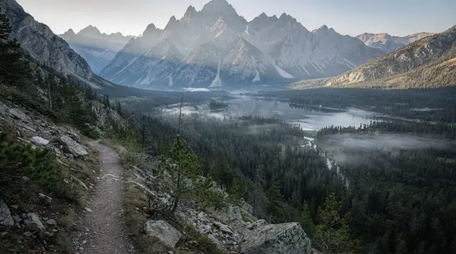
Most visitors photograph Kotor Bay from the water, from a boat deck, or from the switchbacks of the old Njeguši road above Kotor. The Vrmac ridge does something different: it runs like a spine between Kotor Bay and Tivat Bay, so a single path along its crest swaps one sea view for the other every time you cross to the far side of the ridgeline. On a clear day you can stand at the same spot and see the walled roofs of Kotor old town on one side and the marina towers of Porto Montenegro on the other, separated by maybe 500 metres of ridge width.
The ridge itself is a low, forested hill rather than a mountain — its highest points sit under 800 m — which is exactly why it works as a half-day hike rather than a full alpine outing. It was also, a century ago, a defensive line: the Austro-Hungarian garrison that held the Bay of Kotor fortified the ridge with a small fort roughly in the middle, and the fort’s ruin is the main destination for most people who walk up here today.
This guide covers the two things people actually ask about Vrmac: which trailhead to use, and whether you need to walk the whole ridge or can get the view for less effort. Short answer — you don’t need the full traverse. Muo and Dobrota, the two waterside settlements just north of Kotor, both have paths that reach the fort and the viewpoint in a couple of hours round trip, no ridge-length walk required.
Where the trailheads are
There is no single “Vrmac trailhead” — the ridge is accessed from several points along its base, and which one suits you depends on how much of the ridge you want to cover and whether you’re doing a there-and-back walk or a one-way traverse that needs transport at the far end.
| Start point | Distance from Kotor | Route type | Typical time to the fort |
|---|---|---|---|
| Muo | 5-10 min by taxi or a 20-30 min walk along the shore | Steep, direct climb | 1-1.5 hours up |
| Dobrota | 10-15 min by taxi from Kotor | Gentler gradient, longer approach | 1.5-2 hours up |
| Trojica pass (old Njeguši road) | 15-20 min by car | Ridge-top start, flatter walking | 30-45 min to the fort |
| Tivat side (near Gornja Lastva) | 20 min by car from Tivat | Climbs from the Tivat Bay side | 1-1.5 hours up |
Muo gives the shortest, sharpest ascent — useful if you’re short on time and don’t mind a steep 300-400 m of climbing in under an hour. Dobrota’s path is longer but less punishing on the legs, and it passes through olive terraces and old stone walls that make the walk itself more interesting, not just the destination. If you’d rather start near the top and walk mostly along the crest, driving up to Trojica pass on the old road toward Njeguši cuts out most of the climbing and turns the outing into a ridge walk rather than a mountain ascent.
None of these trailheads have paid parking or a visitor centre — you park on the verge or a widened bend in the road, and there’s no facility at the start beyond, at best, a faded wooden signpost. Cars parked in Muo or Dobrota on a hot day are exposed; there’s little shade at the trailheads themselves.
The fort and the two-sea viewpoint
The ruin at the centre of the ridge is what locals and older maps still label Fort Vrmac, built by the Austro-Hungarian military in the decades before the First World War as part of the network of coastal defences that also produced San Giovanni fortress above Kotor and other batteries around the bay. It never saw serious combat and was abandoned well before the Second World War, so what’s left today is a roofless shell of thick stone walls, gun embrasures, and a couple of underground rooms you can duck into with a torch.
There’s no ticket booth, no gate, no opening hours, and no fee — you simply walk up and in. That also means no lighting, no handrail on the drop-offs, and no one checking whether the ruin is currently stable after winter rain. It’s safe to walk around in daylight with basic care; it’s not the place to be exploring after dark or straight after a storm, when loose stone and slick surfaces are a real risk rather than a theoretical one.
The reason people make the climb, though, is less the ruin itself than what’s around it. Standing on the fort’s upper walls, you get Kotor Bay laid out to the west — the inner bay past Perast and Risan, with Our Lady of the Rocks visible as a dot in the water if the light is right — and Tivat Bay to the east, flatter and more open, with the runway at Tivat airport and the yachts of Porto Montenegro below. Few viewpoints around Kotor show both bays from one fixed spot; most either look down into Kotor Bay or out toward the open Adriatic, not both.
Route options and how they compare
If you’re deciding how much of the ridge to walk, the honest comparison is between a short there-and-back to the fort and the full north-south traverse, which is a different kind of day out.
| Route | Distance | Ascent | Time | Notes |
|---|---|---|---|---|
| Muo to fort, return | 6-7 km | ~400 m | 2-2.5 hours | Steepest option, shortest distance |
| Dobrota to fort, return | 8-9 km | ~450 m | 2.5-3 hours | Gentler climb, passes old terraces |
| Trojica pass to fort, return | 4-5 km | ~150 m | 1.5 hours | Least climbing, mostly ridge-top |
| Full traverse, Muo to Tivat side | 12-14 km one way | ~500-600 m | 4-5 hours | Needs transport arranged at the finish |
The full traverse is worth planning properly rather than improvising. Because it’s a one-way route from one bay to the other, you either need a second car left at the far end, a pre-booked taxi to collect you, or a hiking tour that handles the logistics — which is the main practical reason people book a guided option for Vrmac rather than for shorter walks elsewhere around the bay.
a private guide for the full ridge traverse takes care of exactly that transport problem, plus route-finding on sections where the waymarking thins out.
If you’d rather stay closer to Kotor and combine the viewpoint with commentary on what you’re looking at, a guided walk up to the Vrmac viewpoint over Kotor Bay covers the shorter Muo or Dobrota approach with a guide who can point out which village is which across the water.
What the walking is actually like
Below the ridge, on the Muo and Dobrota approaches, the path climbs through old stone-walled terraces — former olive groves and small vegetable plots, many now overgrown — on a mix of stepped stone track and dirt path. It’s steep enough in places to want both hands free rather than carrying bags loosely, though nothing here requires scrambling or ropes.
Once you’re on the ridge itself, the terrain flattens into rolling scrubland: low pine, juniper, and exposed karst rock, with the path alternating between a wide fire-road (used by the mountain-bike route as well as walkers) and narrower dirt tracks nearer the fort and the high points. There is very little continuous shade anywhere on the ridge — the pines are scattered rather than forming a canopy — so the exposure to sun is real for most of the walk, not just at the top.
Waymarking is inconsistent: some junctions have painted trail markers or small signposts, others don’t, and it’s easy to end up on a side path that dead-ends at a viewpoint or a disused terrace rather than continuing toward the fort. Downloading an offline map before you set out is worth the two minutes it takes, since phone signal is patchy in places along the ridge.
Wildlife is part of the appeal for some visitors — Vrmac’s mixed scrub and cliff edges attract raptors and other birds that are harder to see down at sea level, and it’s one of the better spots around the bay for casual birdwatching even without specialist knowledge.
a guided birdwatching outing on the ridge is a slower-paced alternative to a straight hiking route, aimed more at what you can see and hear along the way than at covering distance.
On two wheels instead of on foot
The wider fire-road sections of the ridge, particularly from Trojica pass and along the crest toward the fort, are ridden by mountain bikers as well as walked by hikers. It’s not a route built for bikes — you’re sharing the same narrow track — so on busy weekends it’s worth being alert to riders coming the other way, especially on blind bends near the fort.
an e-mountain-bike route over Vrmac hill is the option if you’d rather cover the ridge on an assisted bike than walk it, useful given how little flat ground there is once you’re above Muo or Dobrota and how much of the ascent an e-bike removes from the day.
Packing and timing
There’s no water source on the ridge and no shop or kiosk at any of the trailheads, so what you carry up is what you have for the whole walk. For the short loop to the fort, 1-1.5 litres per person is reasonable outside midsummer; for the full traverse, plan for at least 2 litres and food, since there’s nowhere to buy either along the way.
| Item | Why |
|---|---|
| Sturdy trainers or hiking shoes | Loose stone and stepped terraces on the lower approach |
| Sun hat and sunscreen | Little continuous shade above the tree line |
| 1.5-2+ litres of water | No taps, springs or shops on the ridge |
| Offline map or downloaded GPX track | Waymarking is patchy at junctions |
| Light jacket in shoulder season | Ridge-top wind is noticeably stronger than at sea level |
Morning starts work best, both for temperature and for light — the two-bay view from the fort is clearest before any afternoon haze builds up over the water, which happens most days in July and August. Outside those two months, late May to mid-June and September give the most comfortable combination of clear air and manageable heat for a half-day walk with real climbing in it. If you’re travelling in winter, check the Kotor off-season guide first — the ridge itself is walkable year-round in dry weather, but wind and rain make the exposed sections unpleasant rather than dangerous.
Getting there and combining it with other days
Muo and Dobrota are both close enough to Kotor old town to reach on foot along the waterside road if you don’t mind adding 20-30 minutes to your day before the climb even starts; a short taxi ride covers the same distance in a few minutes if you’d rather save your legs for the ridge. If you’re driving up to Trojica pass instead, it’s the same road used for the old route to Njeguši, so a Vrmac walk pairs naturally with a stop for prosciutto and cheese on the way back down, or with continuing on to Cetinje if you’ve got the rest of the day free.
Vrmac isn’t the only hike above the bay, and it’s worth knowing where it sits relative to the others before you commit a half-day to it. It’s shorter and less strenuous than the climb up Orjen, the highest of the mountains ringing the bay, and it’s a genuinely different walk from the Ladder of Kotor, which climbs the old mule path directly above the old town rather than running along a ridge between two bays.
Compared with the drive-and-short-walk combination up to Lovćen National Park and the Njegoš mausoleum, Vrmac asks for more time on your feet and gives a lower, closer view of the bay rather than the wide panorama from Lovćen’s greater height.
If a full day of climbing sounds like too much but you still want the fort and the two-bay view, the short loop from Dobrota pairs well with the gentler Dobrota baroque palaces walk at sea level beforehand — one covers the merchant houses along the water, the other the ridge rising directly behind them, and together they make a fuller day out of what’s otherwise a single settlement most visitors pass through quickly on the way to somewhere else. For a first-time visitor deciding how to structure two or three days in the bay at all, the how many days in Kotor and Bay guide is a reasonable starting point before slotting a Vrmac morning into the plan.
Mountain excursions on GetYourGuide
Verified deep-linked GetYourGuide tours. Book through these links and we earn a small commission at no cost to you.
GetYourGuide does not provide a product photo for this activity — the image shows the meeting point, photographed by us.