Hiking Mount Orjen: trails, water and navigation
Is Orjen a good hike for someone based in Kotor?
Only if you already hike unmarked terrain confidently. Orjen rises above Herceg Novi, about 45 minutes from Kotor by the Kamenari-Lepetane ferry, and its limestone ridges have far less waymarking, signage and passing traffic than Lovćen or Durmitor. Bring your own water, a downloaded GPS track, and a backup plan for weather that turns fast.
The mountain most Kotor visitors never hear about
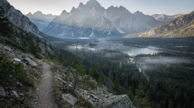
Every visitor to Kotor who looks up sees Vrmac and, further off, the pyramid shape of Lovćen. Orjen doesn’t show from the old town at all. It sits behind Herceg Novi, a limestone massif shared with Bosnia and Herzegovina, and it’s a different kind of mountain from either of Montenegro’s tourist favourites: wetter, less signed, and largely empty of other walkers even in August.
Orjen is a karst massif built from limestone that has been dissolving and collapsing on itself for millions of years. The result is a landscape of dolines - bowl-shaped sinkholes, some tens of metres across - rather than the smooth ridgelines of Lovćen. Underneath, water disappears through cracks in the rock almost as fast as it falls, which is the central contradiction of this mountain: it receives more rainfall than anywhere else in the Balkans, and yet you can walk for hours in summer without finding a drop of it on the surface. The high ground climbs past 1,800 metres, with the ridge running roughly along the Montenegro-Bosnia border.
None of this makes Orjen unwalkable. It makes it a mountain for people who already know how to read a map without relying on paint splashes every hundred metres, and who won’t panic if the cloud comes in and the path underfoot stops looking like a path.
Why Orjen gets so much rain, and why that doesn’t mean water on the trail
The villages on Orjen’s lower slopes, particularly around Crkvice above Risan, record some of the highest annual rainfall totals recorded anywhere in Europe. Moist air off the Adriatic hits the wall of the massif and dumps it there. That’s the headline fact most people repeat about this mountain, and it leads first-time hikers to assume streams and springs will be reliable. They’re often not.
Limestone karst drains internally. Rain that falls on Orjen largely vanishes into fissures, sinkholes and underground channels rather than running off in visible streams, so by midsummer many of the cisterns and marked springs on older maps are dry, silted, or simply gone. A handful of villages maintain water catchment systems for their own use; these are not public taps for hikers. Treat every water source on Orjen as unreliable until you’ve confirmed it that day, ideally with a local guide or a recent trip report, and carry more than you think you’ll drink.
Waymarking is real but thin
Orjen does have marked routes - mostly maintained informally by mountaineering clubs from Herceg Novi and Risan, using the standard red circle with a white centre. The difference from Lovćen National Park or Durmitor is density and upkeep. On Lovćen you’ll see a waymark every few minutes and pass a mountain hut or a road within an hour of almost anywhere. On Orjen, paint fades on exposed limestone, markers can be thirty or forty minutes apart on some stretches, and a network of goat tracks and old shepherd paths crisscrosses the real trail in ways that are easy to follow by mistake, especially in the dolines where sightlines close in.
Fog changes the calculation entirely. Orjen’s summit ridge sits high enough, and close enough to the sea, that cloud can form within an hour with little warning, cutting visibility to a few metres among terrain that already has no obvious linear feature to follow. Hikers used to well-marked parks sometimes assume they can navigate by “heading downhill” - on karst, downhill can lead into a sinkhole rather than a valley.
Practically, that means:
- Download an offline GPS track before you leave Kotor or Herceg Novi; don’t rely on a paper map alone.
- Check the forecast for Herceg Novi and add at least one grade of caution - conditions on the ridge run cooler, windier and wetter than the coast.
- Turn back at the first sign of closing cloud if you’re not confident reading the terrain.
- Start early. Afternoon storms are common in the warmer months.
Getting to a trailhead from Kotor
There’s no direct trail from the Bay of Kotor onto Orjen; you approach from the Herceg Novi side. From central Kotor, drive the coast road or cross the bay on the Kamenari-Lepetane ferry, then continue to Herceg Novi (about 45 minutes from Kotor by the ferry route) before climbing inland on narrow mountain roads toward villages such as Kameno, Ubli or Bijela’s hinterland, where most trails begin. Budget at least 1.5 hours door to trailhead, more if you’re relying on buses, since public transport thins out fast once you leave the coast road - see the general picture in the guide to buses in Montenegro.
A rental car is close to essential here. If you’re deciding whether to hire one for your stay, the car rental guide for Montenegro covers what to expect on mountain roads like these.
Route options and what they actually demand
Treat the times below as a starting point, not a guarantee - pace on unmarked karst varies more than on a graded path, and fog or heat can add significant time.
| Route | Typical duration | Ascent | Who it suits |
|---|---|---|---|
| Lower slopes from Kameno or Ubli (partial loop) | 3-4 hours | 400-600m | First visit to Orjen, testing the terrain before committing to more |
| Mid-mountain traverse through the dolines | 5-6 hours | 700-900m | Hikers comfortable without constant waymarking |
| Ridge approach toward the high ground (over 1,800m) | 7-9 hours, best as an early start | 1,000m+ | Experienced hikers only, ideally with a guide or a known GPS track |
| Multi-day traverse toward the Bosnia and Herzegovina border area | 2 days with an overnight stop | Varies | Specialist trip; needs planning most visitors won’t do independently |
None of these routes have the amenities you’d find on Durmitor National Park or around Žabljak - no cafés at the trailhead, no staffed huts to fall back on, and no queue of other hikers to flag down if something goes wrong. Plan accordingly.
What you’ll actually see
Orjen’s reward for the extra caution is a landscape you won’t find on Montenegro’s more photographed summits. The dolines are the signature feature: bowl-like depressions, some holding pockets of cooler air and different vegetation than the slopes around them, a few still farmed in small patches by families from the villages below. Beech and black pine cling to thin soil between exposed grey limestone pavement, and in spring the ground between the rock is thick with alpine flowers that don’t get the foot traffic to wear them down.
From the higher points, the view opens over the Bay of Kotor from an angle almost nobody photographs - the ria stretching below is visible as a shape you don’t get from the water or from Vrmac, with the Adriatic beyond it and, on a clear day, the coast running down toward Bar. On the Bosnia and Herzegovina side, the ground falls away into a drier, more open karst plateau that looks and feels like a different country, which it is.
What you won’t find is infrastructure. No cable car, no marked viewpoint with a bench, no signal for most of the walk. That absence is the point for the hikers who seek Orjen out, and the reason it’s the wrong choice for anyone wanting a gentle first mountain outing.
Guided alternatives, if Orjen isn’t the right fit
Orjen rewards experience, and it’s fair to say plainly that many visitors to Kotor will be better served elsewhere on their first Montenegrin mountain day. If you want a guided hike with a marked route and a driver who knows the roads, the private tour up Lovćen and through Njeguši covers similar karst scenery and views over the bay with none of the navigation risk.
For something shorter and closer to Kotor, the guided walk along the Vrmac ridge is a half-day option with waymarked paths and views back down over the old town. And if you’d rather see Montenegro’s mountains from a vehicle with stops for photos and wine rather than on foot, the Blue Sea Black Mountains tour covers a broader sweep of the country’s high ground with a driver-guide doing the navigating.
When to go
Late May through June, and September, are the best windows: the worst of the winter wet has drained through the karst, temperatures are manageable for a multi-hour climb, and days are long enough to allow an early start with margin. Snow can sit on the highest ground into May in a heavy year, and the same rain that gives Orjen its reputation can turn a dry gully into a running channel with little warning in spring.
July and August bring heat with almost no shade above the treeline, and afternoon thunderstorms build quickly over the ridge - start at first light and be off the high ground before early afternoon. For a broader sense of how the seasons play out along the coast, see the best time to visit Kotor guide; Orjen runs a notch cooler and wetter than the numbers there suggest, given the altitude and the exposure to weather coming off the Adriatic.
What to bring
Beyond the standard hiking kit covered in the general Montenegro packing guide, Orjen has a few non-negotiables:
- Water: 2 to 3 litres minimum per person, more in summer. Do not plan a route around finding water on the mountain.
- An offline GPS track or a detailed paper map with a compass - phone signal cannot be relied on for navigation once you’re past the lower villages.
- Layers. Temperature and cloud cover can shift fast near 1,800 metres, even when Herceg Novi below is warm and clear.
- A basic first aid kit and a means to call for help where signal allows; tell someone in Kotor or Herceg Novi your planned route and return time.
- Sturdy boots with ankle support. Limestone pavement and loose scree punish trainers.
For anything beyond a day walk, check the health and pharmacies guide for what’s realistically available if you need it - options thin out quickly once you’re away from the coast.
If you’d rather stay closer to the coast
Not every visitor to the Bay of Kotor needs a mountain this demanding, and that’s a reasonable call. Herceg Novi’s old town sits at the foot of Orjen with a fraction of the effort, Vrmac offers waymarked ridge walking within sight of Kotor itself, and Njeguši combines an easier mountain drive with the region’s best-known prosciutto and cheese. For travellers building a longer stay without a car, the Montenegro without a car itinerary sketches out what’s realistically reachable by bus and ferry, and Orjen, honestly, mostly isn’t one of them.
FAQ: hiking Mount Orjen
How do I get to the Orjen trailheads from Kotor?
There’s no direct route. Drive around the bay or take the Kamenari-Lepetane ferry (about 45 minutes to Herceg Novi), then climb the mountain road towards villages like Kameno or Ubli, where most trailheads start. Allow at least 1.5 hours from central Kotor to a trailhead.
Is Orjen harder than Lovćen or Vrmac?
Physically not always steeper, but navigationally yes. Lovćen and Vrmac have marked paths, visible huts and other walkers. Orjen has patchy red-and-white paint, few signs past the lower slopes, and long stretches where you won’t see anyone else.
Do I need a guide on Orjen?
Not legally required, but strongly worth it unless you’re an experienced off-trail hiker with a GPS track loaded in advance. A local guide knows which dolines to avoid in fog and where the reliable water sources actually are that season.
Is there water on the trail?
Sometimes, but never guaranteed. Orjen is the wettest mountain in the Balkans by rainfall, yet its limestone drains fast, so surface water and cisterns can be dry even after a wet spring. Carry at least 2 to 3 litres per person and don’t rely on any spring shown on a map.
What is the best time of year to hike Orjen?
Late May to June, and September, when temperatures are manageable and the ground has mostly dried out. July and August bring heat with little shade above the treeline. Snow and ice can linger into May on the higher ridges, and fog rolls in with little warning most of the year.
Can I combine Orjen with Herceg Novi in one day?
Yes, and it’s the sensible plan. Hike a lower or half-day route in the morning, then descend to Herceg Novi’s old town for lunch and the walk back down to sea level, rather than trying to summit and sightsee in the same day.
Is mobile signal reliable on Orjen?
No. Coverage is patchy to absent on much of the ridge, particularly on the Bosnia and Herzegovina side of the border area. Tell someone your planned route and expected return time before you start.
Mountain excursions on GetYourGuide
Verified deep-linked GetYourGuide tours. Book through these links and we earn a small commission at no cost to you.
GetYourGuide does not provide a product photo for this activity — the image shows the meeting point, photographed by us.