First, the disambiguation
Search “Njivice Montenegro” and most results will show you a package resort on the Croatian island of Krk, in the northern Adriatic, complete with a marina, campsites and package hotels. That is a different Njivice, in a different country, roughly 500 kilometres to the north. The Njivice in this guide is a small settlement on the slopes of Mount Orjen, in the hills directly above Herceg Novi, on the Montenegrin side of the border with Croatia. It has no beach, no marina and, most of the year, closer to a hundred residents than a thousand tourists. If a booking site or a map app pulls up hotel listings in Krk, you have the wrong Njivice.
The two places share a name for an unremarkable reason — “njivice” is simply the Montenegrin and Croatian word for small fields or plots, a common enough placename across the region. There is no historical or administrative link between them.
Where Njivice sits, and why the altitude matters
Njivice lies on the eastern flank of the Orjen massif, the limestone range that rises directly behind Herceg Novi and forms the natural wall between the coast and Bosnia and Herzegovina’s Trebinje region. The village sits at several hundred metres above sea level, on a shelf of pasture and scattered stone houses reached by a narrow road that switches back repeatedly as it climbs out of Herceg Novi.
That altitude is the entire reason to come. Nearly every well-known viewpoint around the Bay of Kotor — Perast’s waterfront, Dobrota’s promenade, the ramparts of Kotor’s old town — looks at the bay from the water’s edge, at a level with the boats and the reflections.
From Njivice, and from the open ground above it toward the Orjen ridgeline, you look down onto the bay instead: its full outline of inlets and peninsulas laid out at once, the switchback road up to Vrmac visible as a thread on the far shore, cruise ships in the Kotor basin reduced to the size of a fingernail. It is the same body of water most visitors only ever see from a boat deck or a café table, seen instead the way it would look from a small aircraft.
The trade-off is obvious and worth stating plainly: there is no swimming here, no old town, no restaurant terrace with a bay view built for tourists. Njivice rewards people who want the view and are willing to drive a mountain road and walk a bit to get it, not people looking for a relaxed half-day out.
Getting there
The most direct route from Kotor runs via the Kamenari–Lepetane ferry, which cuts across the narrowest point of the bay and saves the long drive around through Risan. From the Lepetane side, the road continues to Herceg Novi, and from there a signed mountain road climbs toward Orjen; Njivice is reached after roughly 20–25 minutes of climbing from the edge of town. Total travel time from Kotor is around an hour, ferry queue permitting — in July and August that queue can add 20–40 minutes at peak times, so this is not a trip to plan around a tight schedule in high season.
The alternative, avoiding the ferry entirely, is to drive the full loop around the bay through Risan and Herceg Novi; this adds roughly 20–30 minutes over the ferry route but removes any uncertainty about waiting.
The mountain road itself deserves a specific warning. It is narrow, has no barrier in several stretches, and includes blind corners where oncoming traffic — sometimes a delivery van, sometimes a local driver who knows the road far better than you do — appears with little notice. This is not a road for a nervous driver’s first mountain drive in Montenegro; if the old road to Njeguši already felt like more than you wanted, treat this one the same way. A rental car with reasonable ground clearance is fine; a low-slung city car will scrape on a couple of the tighter switchbacks after rain has washed gravel onto the tarmac.
There is no public bus service to Njivice. Buses in Montenegro run along the coastal corridor between Kotor, Tivat and Herceg Novi reasonably often, but they do not climb into the Orjen foothills. Reaching the village without a car means arranging a taxi from Herceg Novi — agree the fare before getting in, since taxis in Kotor and the wider bay area rarely run the meter with visitors — or joining a private hiking or driving tour that includes the climb.
What there is to do
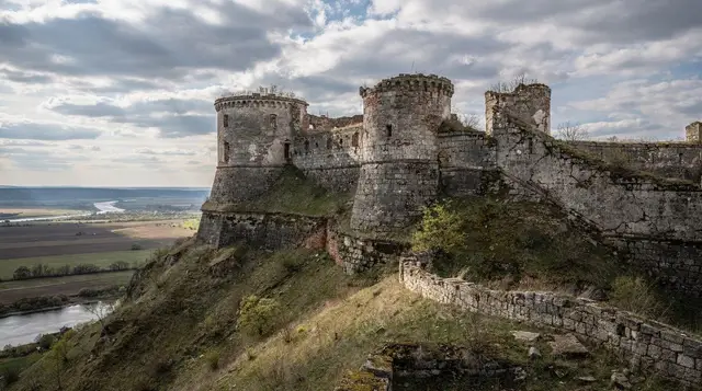
Njivice itself is modest: a scattering of stone houses, a small church, grazing land, and views in most directions once you’re clear of the trees. There is no museum, no set of “sights” to tick off in sequence. The two things that justify the trip are the viewpoint and the hiking.
The viewpoint. The open ground above and around the village gives an unobstructed look over the full sweep of the Bay of Kotor — the mouth near Herceg Novi and Igalo, the inner basin toward Kotor and Perast, and on a clear day the coast stretching toward Tivat and the Lustica peninsula. Morning and late afternoon give the best light and the least haze; midday sun in summer tends to wash the view out and the exposed ground offers little shade.
Hiking into Orjen. Njivice functions as a lower access point for trails climbing toward the higher parts of the Orjen massif, Montenegro’s highest limestone range and one that gets far less foot traffic than Lovćen or the trails around Vrmac.
Marking on the ground is inconsistent — do not expect the signage density of a national park — and mobile signal drops out in several stretches once you’re above the village. This suits experienced hikers with a downloaded map and appropriate footwear far better than a casual stroll; anyone wanting a supported, guided version of Orjen or the neighbouring ridges is better served booking ahead rather than improvising on the day.
For a comparable elevated-view hike with better-marked trails and a shorter approach, the ridge above Vrmac or the old mule path known as the Ladder of Kotor are easier options reached directly from Kotor, without the mountain drive.
a private guided hike on the Vrmac ridge, a gentler alternative with a similarly elevated bay viewIf Orjen and its trails are what draws you here, it’s worth comparing the day against a guided outing on Lovćen instead, which has a paved approach road, a marked summit trail, and Njegoš’s mausoleum at the top as a fixed destination:
a private tour up to Lovćen and the Njegoš mausoleumPracticalities: food, facilities, and what to bring
Do not plan on finding lunch in Njivice. There is, at most, a small shop or seasonal stall depending on the year and who is running it that season — nothing reliable enough to build a day around. Bring water, sun protection (there is little shade on the open hillside), and any food you’ll want, especially if you’re extending the visit into a hike. The nearest reliable eating options are back down in Herceg Novi, where the old town has a normal spread of cafés and konobas at coastal, not mountain-premium, prices.
Toilets, fuel and mobile signal should all be assumed absent once you’re past the edge of Herceg Novi. Fill the tank and use facilities before starting the climb.
Weather changes faster at this altitude than it does on the coast. Cloud can settle on the upper slopes within an hour even on a clear coastal morning, and the same limestone terrain that makes Orjen dramatic also makes it slick and disorienting in fog. If the summit ridge is in cloud from the coast road, treat that as a sign to stay lower or turn back rather than push on for a view that will not materialise.
When to go
| Season | Conditions in Njivice | Verdict |
|---|---|---|
| Late May–June | Warm, trails dry, wildflowers still out, visibility usually good | Best window |
| July–August | Hot climb, midday sun harsh on exposed slopes, ferry queues add time to the approach | Doable early morning only |
| September | Cooling, clear air, fewer people on the mountain roads | Very good |
| October–November | Cooler, increasing rain and cloud on the ridge | Check forecast before driving up |
| December–March | Cold, snow possible above the village, road can be treacherous | Not recommended without local advice |
Combining Njivice with the rest of the bay mouth
Njivice sits within the wider Herceg Novi and the bay mouth area, which is generally under-visited compared with Kotor and Perast despite being no further from the water. A practical day combines the morning drive up to Njivice with an afternoon back down at sea level — Herceg Novi’s old town for lunch and a walk, or a boat trip out toward the Blue Cave near the Lustica peninsula, which departs from the Herceg Novi and Bijela area rather than from Njivice itself.
a speedboat trip to the Blue Cave with snorkelling, departing from Herceg NoviFor a smaller-boat, more flexible version of the same trip:
a Blue Cave speedboat outing from Bijela with swimming stopsAnyone without a rental car should weigh whether the Njivice detour is worth arranging transport for on its own. The guide to exploring Montenegro without a car is honest about where that approach breaks down, and a mountain village with no bus service and unreliable taxi availability is one of those places. If a car isn’t in the plan, the sea-level villages around the bay or a boat tour give a comparable, easier day.
For travellers weighing how much time to give the whole bay area, including detours like this one, see the guide on how many days to spend in Kotor and the bay and the practicalities in parking in Kotor and renting a car in Montenegro before the trip.
Njivice, Montenegro: frequently asked questions
Is this the same Njivice as the resort in Croatia?
No. This Njivice is a small village on the slopes of Mount Orjen above Herceg Novi, in Montenegro. The better-known Njivice with hotels, a marina and campsites is on the island of Krk, in Croatia, roughly 500 kilometres north. The two have no connection beyond a common word — “njivice” means small fields — and confusing them will send you to the wrong booking pages entirely.
How do I get to Njivice from Kotor?
By car, via the Kamenari–Lepetane ferry and then Herceg Novi, followed by a climbing mountain road; the whole trip takes about an hour, longer if the ferry queue is long in July or August. There is no public bus to the village, and taxis need to be arranged with a fixed price agreed in advance.
Is the road up to Njivice difficult to drive?
Yes, relative to the coastal roads. It’s narrow, has unguarded drops in places, and includes blind switchbacks with local traffic that knows the bends better than a visitor will. It suits a driver already comfortable with mountain roads; if roads like the old route to Njeguši already felt tight, expect this one to feel more demanding, not less.
What is there to actually do in Njivice?
Two things: the elevated viewpoint over the Bay of Kotor, and access to hiking trails climbing into the Orjen massif. There are no museums, restaurants to speak of, or organised attractions in the village itself.
Can I eat or buy supplies in Njivice?
Not reliably. Bring water and food with you, and fill up on fuel before leaving Herceg Novi. The nearest dependable restaurants and shops are back down in Herceg Novi’s old town.
Is Njivice worth visiting if I’m not hiking?
Only for the view, and only if you’re comfortable with the drive to get it. Without an interest in the elevated perspective over the bay or in walking further into Orjen, the time is better spent at one of the sea-level villages around the bay, which offer easier access and more to do once you arrive.
Does mobile signal work in Njivice?
Coverage is inconsistent in the village and drops out in stretches of the higher trails. Download offline maps before setting out if you plan to hike beyond the village itself.
When is the best time to visit Njivice?
Late May through June and September give the most reliable combination of clear visibility and comfortable hiking temperatures. July and August bring harsh midday sun on the exposed slopes and longer ferry queues on the approach; winter can bring snow and hazardous driving conditions on the upper road.